By Alice Kaufman, Legislative Advocate
How should you design a levee? Most people would answer that levees are intended for flood protection, and that bare or nearly bare earthen embankments, with water on one side and land on the other, do the job. The levees we are most familiar with in the Bay Area are just that. They create an abrupt transition between the development and infrastructure of the Bay Area and the waters of the Bay. And as sea level rise continues to threaten the many homes, businesses and other infrastructure located near the Bay, it might be expected that we would simply raise those bare walls higher and higher to keep out the rising seas, cutting our communities off from the Bay’s habitat and wildlife in the name of flood protection.
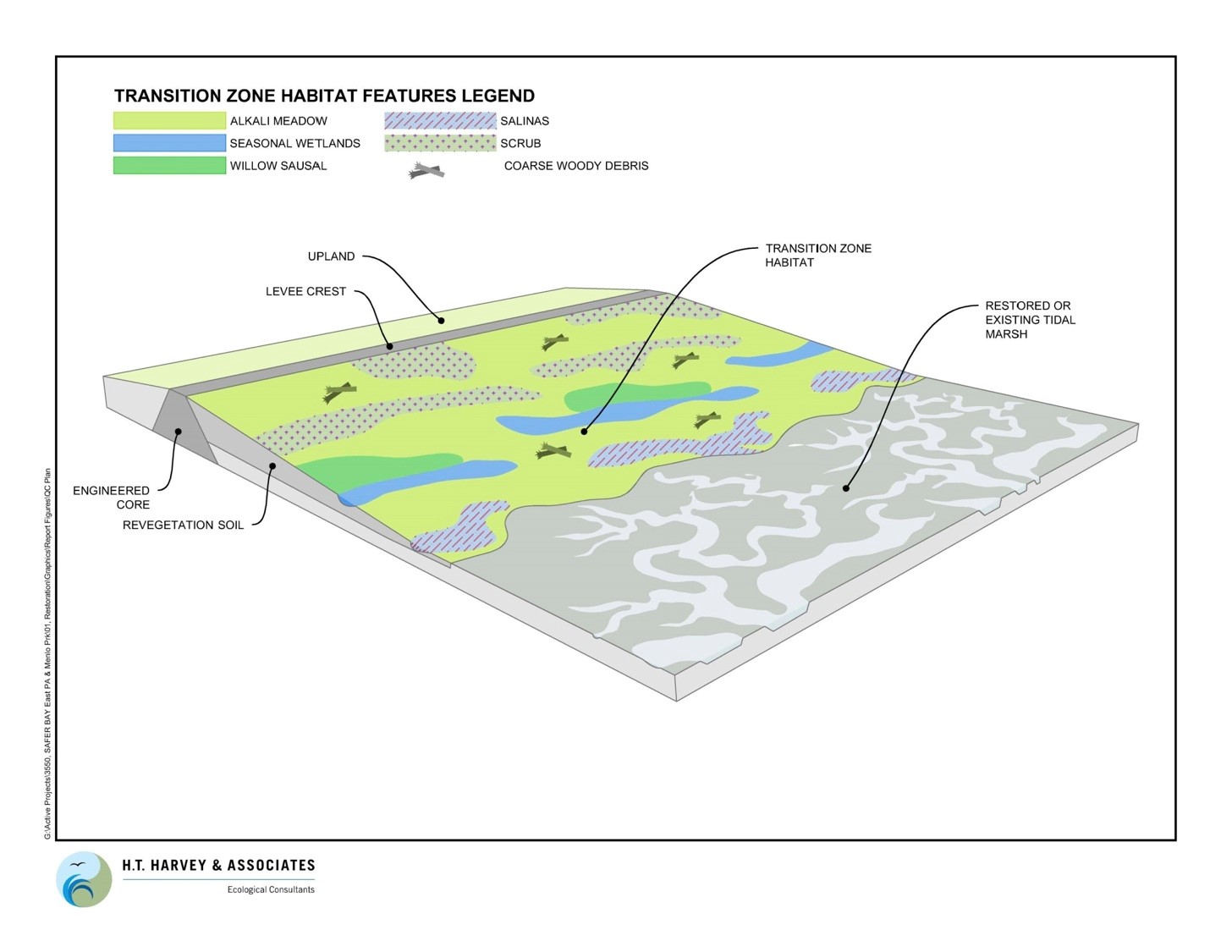
But a new paradigm is being developed which combines traditional flood protection with the goal of restoring tidal marsh and tidal flat habitat. Sometimes called “horizontal levees” or “living levees,” this model incorporates a levee that, instead of dropping down sharply on the Bay side, slopes gently downwards in the same way that the land in the Bay Area did hundreds of years ago, before the marshes were filled and the tidal flats diked off for salt ponds. This allows for natural, gradual transitions—from open water, to tidal mudflat, to tidal marsh, to “ecotone” or transitional upland habitat—to be re-established in these areas.
Living levees provide better protection against sea level rise, since the gradual slopes and tidal marsh vegetation act to slow storm surges and absorb floodwaters. As a result, the earthen levee system can be lower than it would otherwise have to be, saving significant costs in construction and reducing the visual barrier between the Bay and the protected community behind the levee.
Moreover, the environmental benefits of living levees are significant. San Francisco Bay once contained 200,000 acres of wetlands, but due to filling and diking activities, only 40,000 acres remain. Tidal wetlands are the “lungs of the Bay,” filtering pollution and absorbing carbon from the atmosphere. Wetlands also provide habitat for numerous species, including threatened and endangered species such as the salt marsh harvest mouse, Ridgway’s rail (formerly known as the California clapper rail), and western snowy plover. As restoration efforts have moved forward over the past few years, these species’ populations have slowly begun to increase; however, sea level rise could wipe out these species’ habitats if we follow to the old model of levees and create no additional wetlands.
Recent flood protection plans are incorporating this new model. The South San Francisco Bay Shoreline Study is proposing levees for the northern edge of San Jose (north of the Alviso neighborhood and the San Jose wastewater treatment plant) that would include 2,900 acres of tidal marsh habitat and ecotone. The SAFER (Strategy to Advance Flood Protection, Ecosystems and Recreation) Bay project being designed by the San Francisquito Creek Joint Powers Authority also plans to include living levees, which would extend from the northern boundary of Menlo Park to the southern boundary of Palo Alto.
Committee for Green Foothills will work over the next year to help secure funding for these and other living levee projects so that we may all continue to enjoy the wonderful wildlife and open space of the baylands while still protecting our communities against sea level rise.


Leave a Reply